Yushan anther Peaks(¥É¤s«á¤®p)
Yushan another 5 Peaks: Yushan South Peak, DongXiaoNanShan, Lushan, South Yushan and Xiaonanshan.
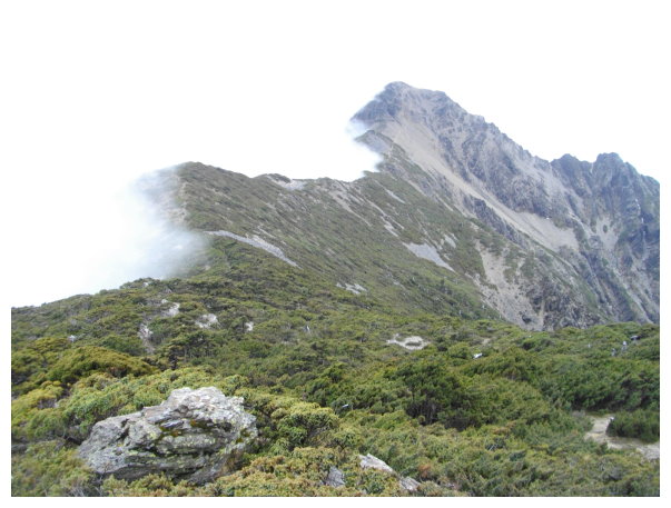
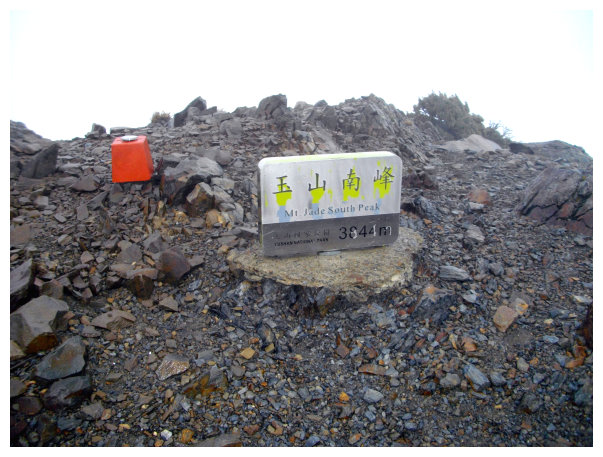
Yushan South Peak: Altitude: 3844 meters. It was ranked No.4 on the list of 100 Peaks in Taiwan, and its steep and cliffy shape looked like a knife.Difficulty rate: 6
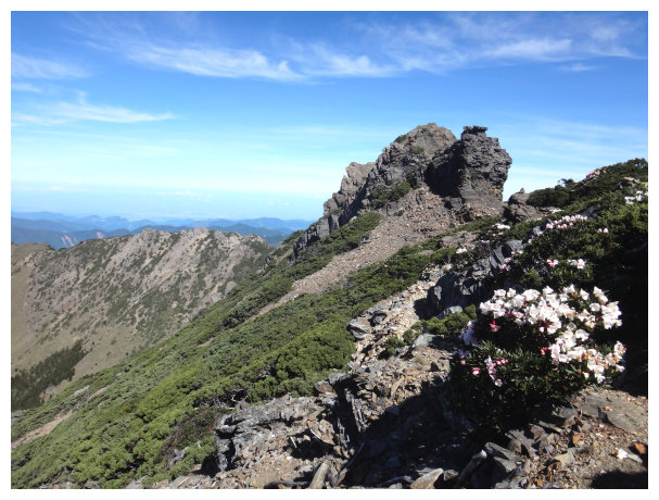
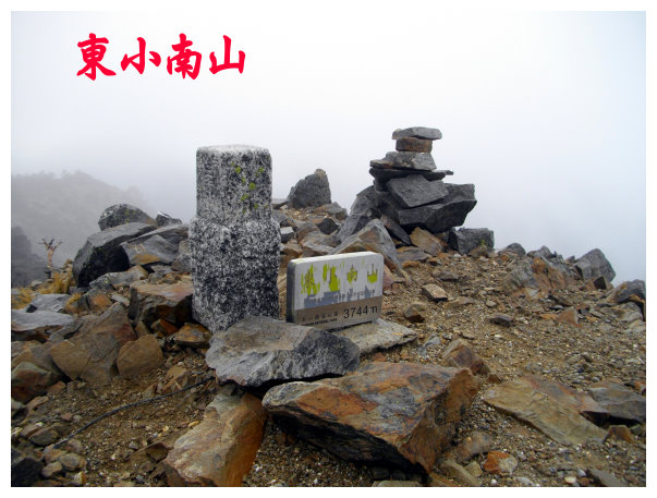
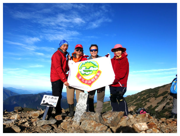
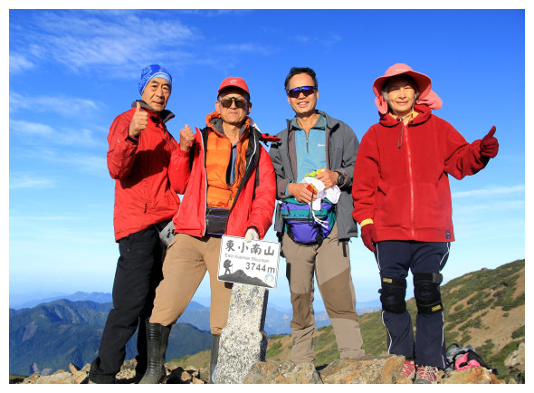
Dongxiao Nanshan: Altitude3,744M. It was ranked No.10 on the list of 100 Peaks in Taiwan. It was the eastern extension of Yushan South Peak.The ridge was a gentle hillside, and its top was covered with gravels. Difficulty rate: 5.2.
Lushan: Altitude :2981 M. It was ranked No.96 on the list of 100 Peaks in Taiwan. It was on the end of the eastern extension of Yushan South Peak. The rest mountains of Yushan were all in its West. Laonong River was below. Difficulty rate: 7.9
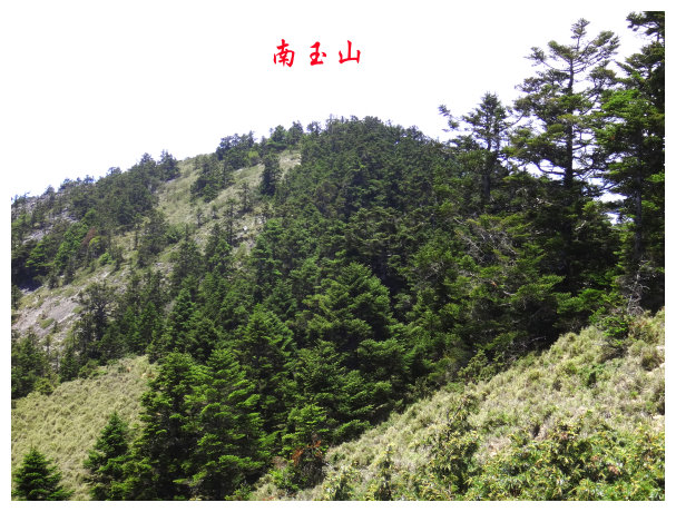
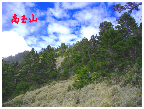
South Yushan: Altitude: 3,383M . It was ranked No.38 on the list of 100 Peaks in Taiwan. It was the southern extension of Yushan Main Peak.The ridge in the northeast side was a gentle slope, but its southwest was jagged and steep. Difficulty rate: 7.6
Yushan Xiaonanshan: Altitude 3582M. It was next to South Yushan. It wasn¡¦t on the list of 100 Peaks, but its scenery was wonderful. Difficulty rate: 7.5
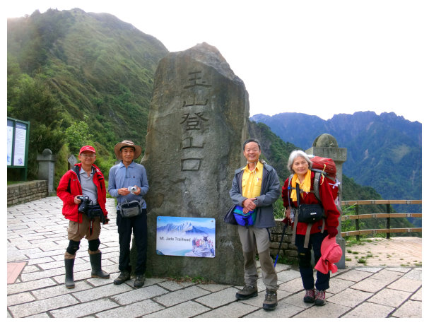
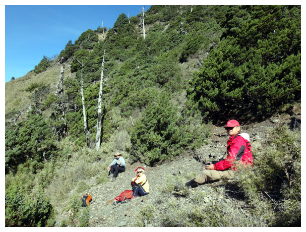
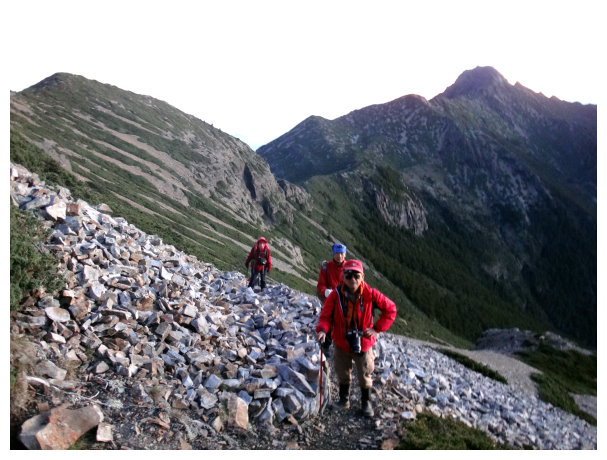
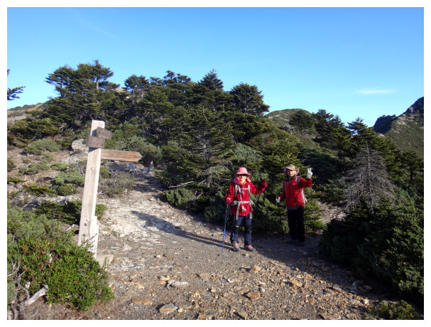
The members of this hiking tour were all over the age of 60. Those mountaineers in good shape might shorten the hiking time.
itinerary
D-1 Chiayi / Dongpu Lodge
18:30 set off from Chiayi.
21:00 got to Dongpu Lodge.
D+1 Dongpu Lodge / the trailhead of Yushan / Paiyun Lodge / stayed a night at Yuanfong Cabin
06:30 walked to Tataka Squad and handed in permits to Paiyun Mountaineering Center, and then took the shuttle bus to the trailhead of Yushan.
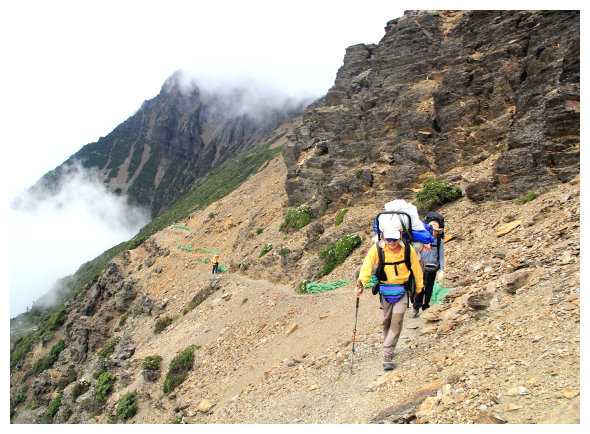
07:10 started our hike.
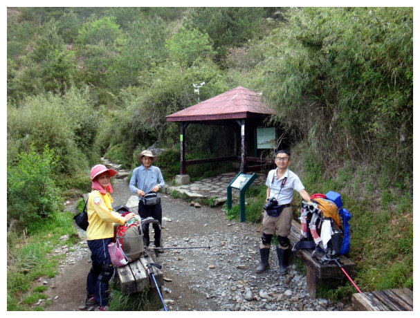
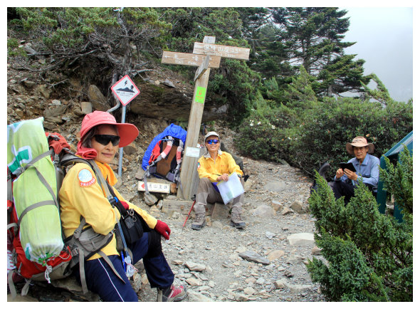
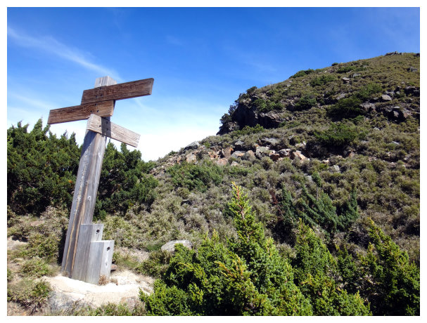
07:36 got to Monroe Pavilion(©s¸S«F) and took a break for 10 minutes. There was a dry-eco toilet on the upper right.
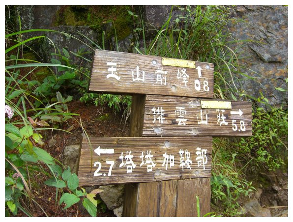
08:14 got to 2.7K, here was the trailhead of Yushan Front Peak. Took a 10-minute break for.
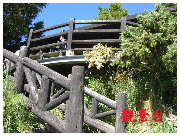
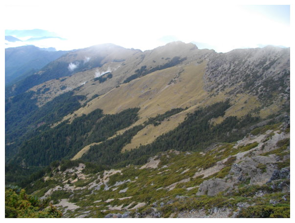
09:40 got to 4.8K, there was an observation platform. We took a 20-minute break. Paiyun Lodge was 4k away, and the change in elevation from here to Paiyun Lodge was 420meters.
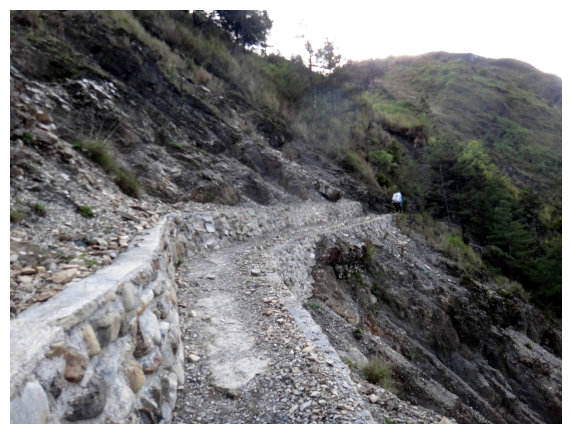
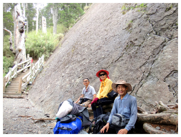
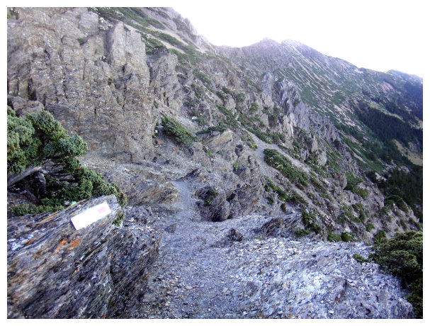
10:40 passed by a big rocky wall.
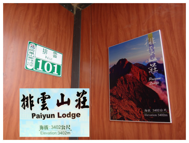
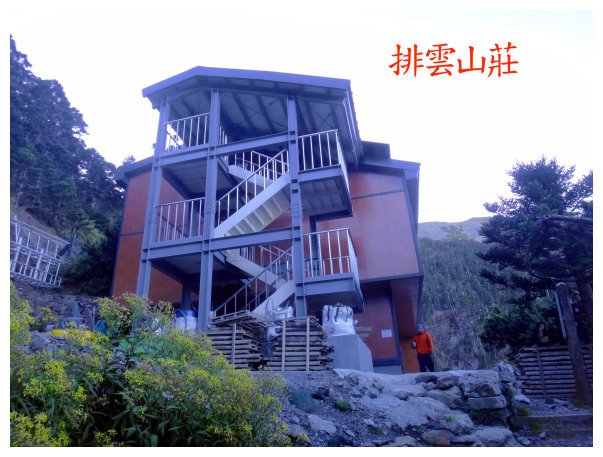
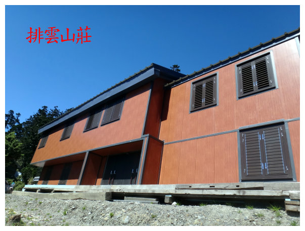
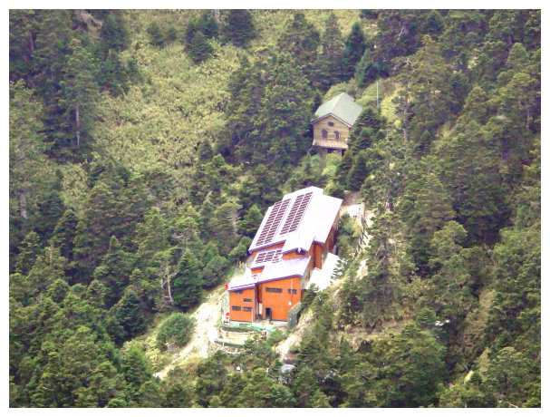
12:10 got to Paiyun Lodge, an elevation of 3405M. Yuanfong Cabin was 2.2k away, and the change in elevation from here to Yuanfong Cabin was 200 meters. After having lunch for 50 minutes, we restarted our hike.
13:40 an intersection of the Main Peak and Yuanfong Cabin, a sign indicated <¶ê®pYuanfong Cabin 1.5K&¥É¤sYushan Main Peak 1.9K>. took a 20-minute break.

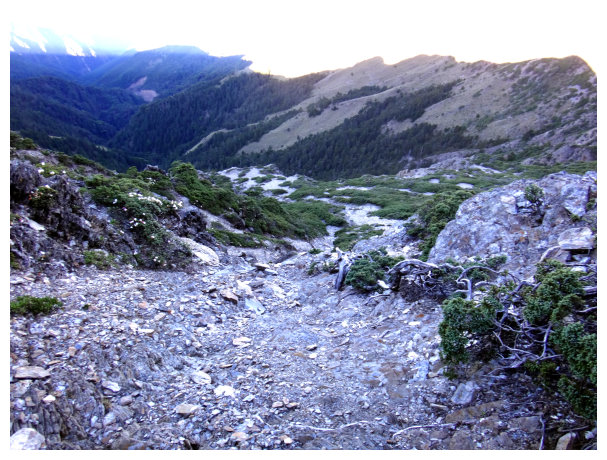
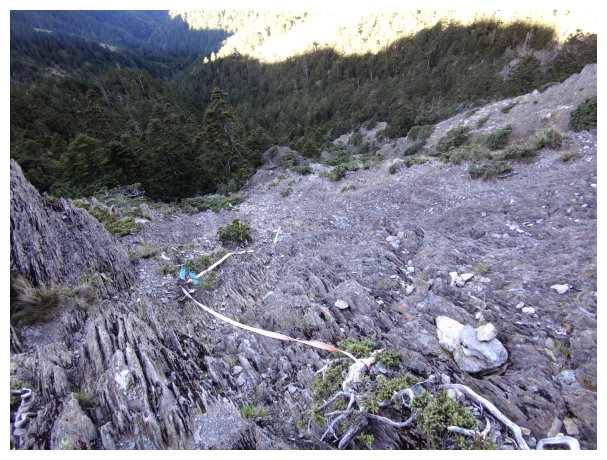
14:20 got to the Paiyun Rain Gauge Station established by Central weather bureau. There were some gravels and cliffs on the way to Yuanfong Cabin, so hikers should be careful.
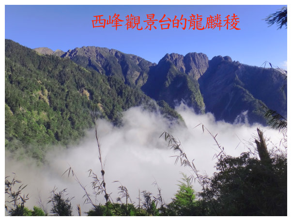
«B¶qp®Ç¤@´Ê³y«¬¹³Às¹³ªêªº¥É¤s¶ê¬f
14:50 followed the indicators to go. We could see Yuanfong Cabin below about 300 meters away.
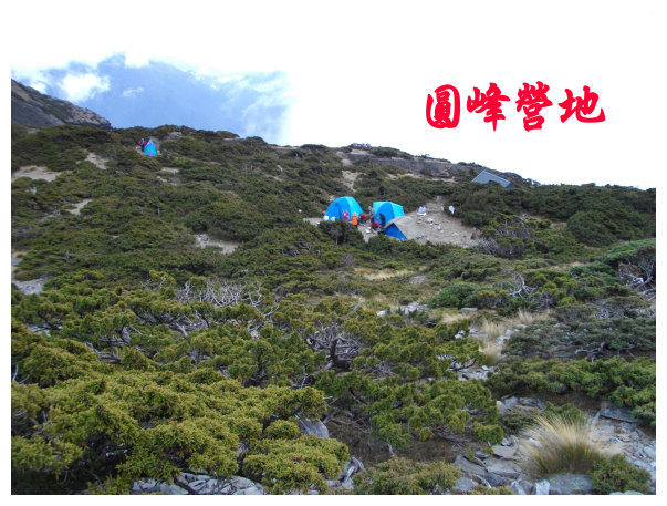
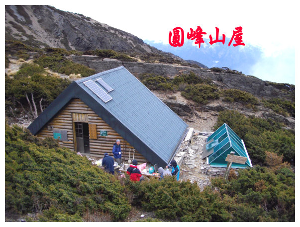
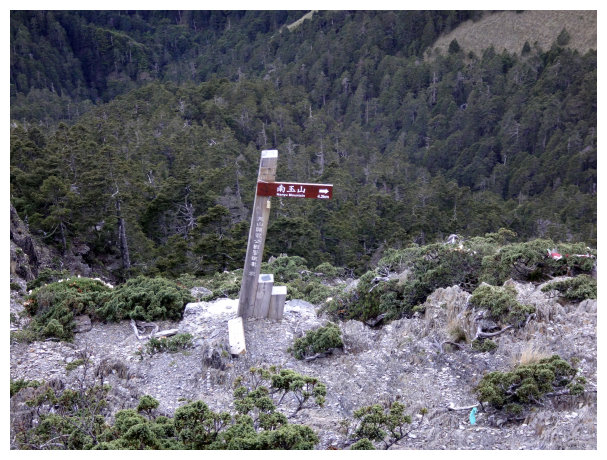
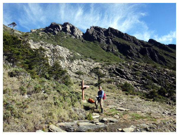
15:10 Arrived at Yuanfong Cabin, an elevation of 3640 meters. A sign said < South Yushan 5.5K& Yushan South Peak 1.7K & Paiyun Lodge 2.2K>. it could accommodate 15 people, and there was a camping site, tables And a water tank out of the cabin. When water shortage, hikers could get the living water near the parking apron.
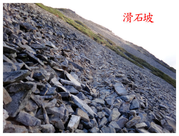
It should take 40 minutes to walk back and forth, because the trail was unstable 70-degree steep gravel slope. At night, you could find sambar deer searching for food, and those deer were not afraid of being close to people.
D+2 Yuanfong Cabin / South Yushan / Yushan Xiaonanshan / stayed a night at Yuanfong Cabin
05:50 packing light, we hiked from the left side of the cabin.
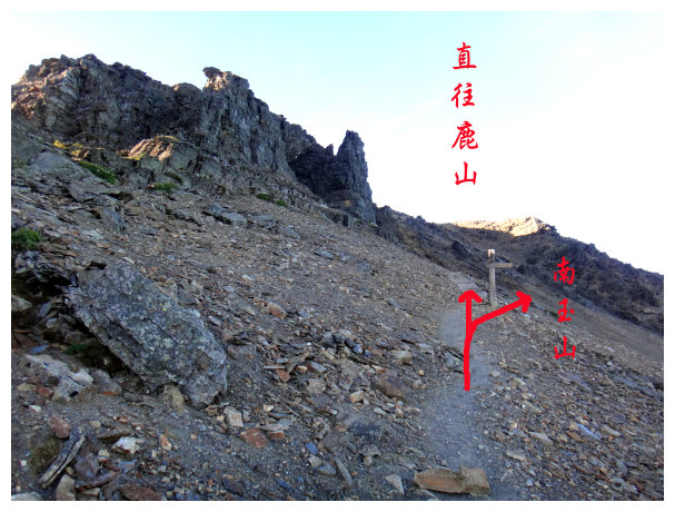
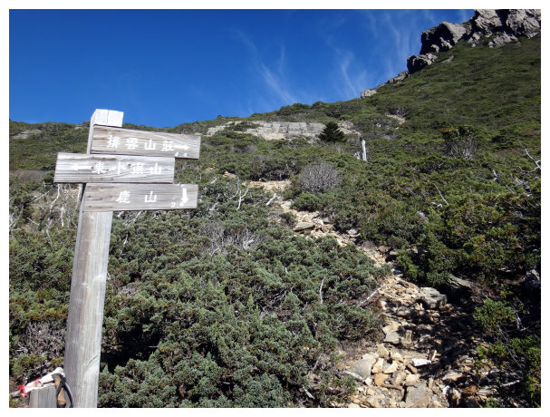
06:12 an intersection. Indicator < right to South Yushan 4.7K ¡® up straight to DongxiaoNanshan 1.6K ¡® Yuanfong Cabin 0.8K). we took the path on the right to go.
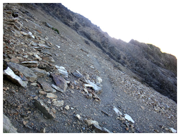
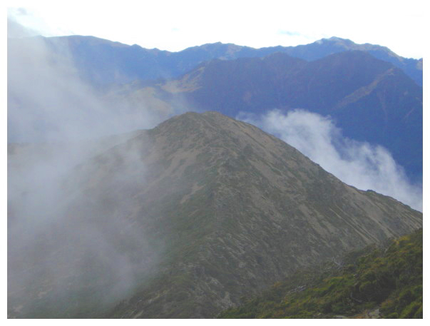
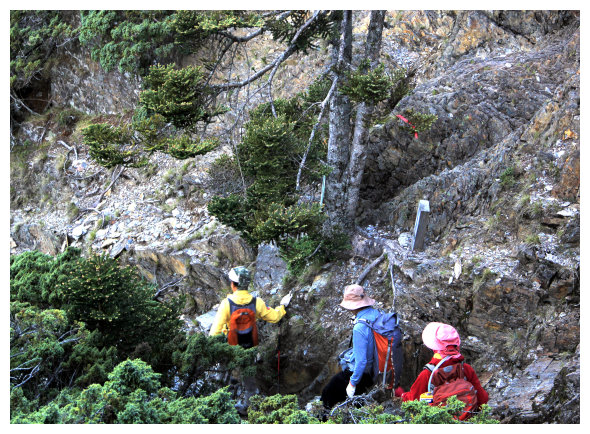
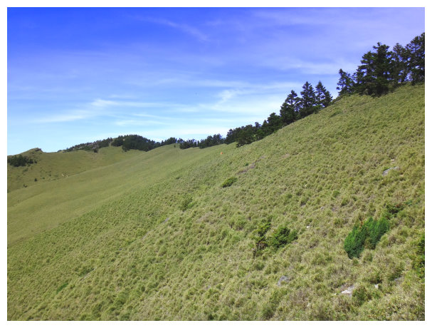
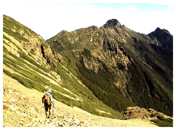
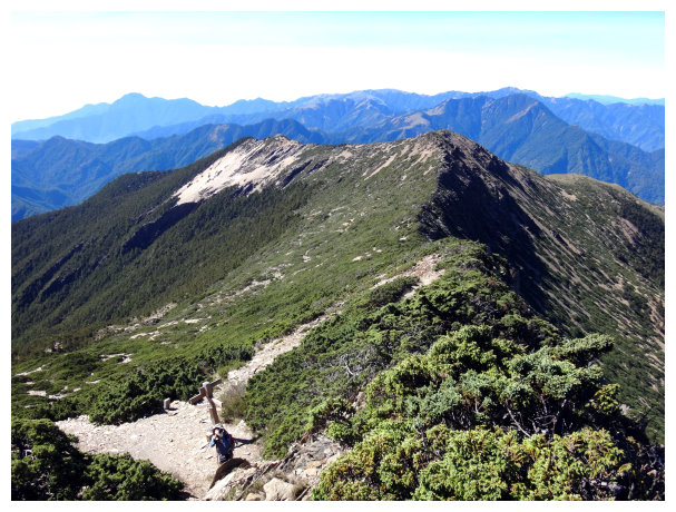
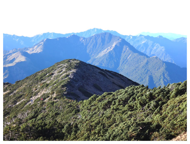
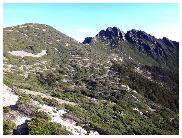
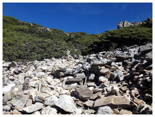
06:25 got to the highest point of this ridgeline. An indicator < South Yushan 4.5K and Yuanfong Cabin 1K>. we could see Guanshan and Xiangyang Mountain far away. The trail was on collapse terrain and steep slope, so hikers should be careful.
06:55 at an intersection. An indicator <back to Yuanfond Cabin 1.3K & going right to South Yushan 4.2K>
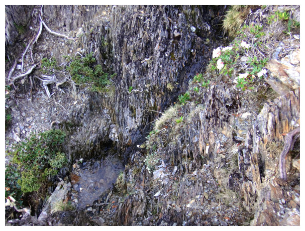
We took the way on the right to go to South Yushan. Walking further about 5 meters, we saw the first water source. It was the highest mountain spring in Taiwan.
07:10 got to a pine forest area. We took the trail on the right and went down about 50meters, and then took a detour to the right to get down there.
07:26 Down to <South Yushan 4.0K> an indicator. After walking 10 minutes, we passed the second water source, which was smaller than the first water source, but the water also tasted sweet.
07:50 got to the third water source. But there was no any water then. Kept hiking and then took a short break on a flat rock. Going further was a trail covered with arrow bamboo.
08:10 down to < South Yushan 3.5K> an indicator. Still walking in arrow bamboo trail.
08:47 an indicator < South Yushan 2.6K & Yuanfong Cabin 2.9K >. We took a break for 10 minutes here. walking further about 10 minutes, we saw an indicator < South Yushan 2.5K & Yuanfong Cabin 3K >.
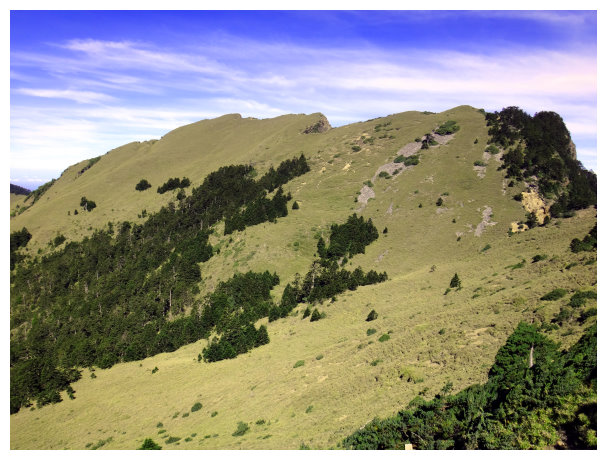
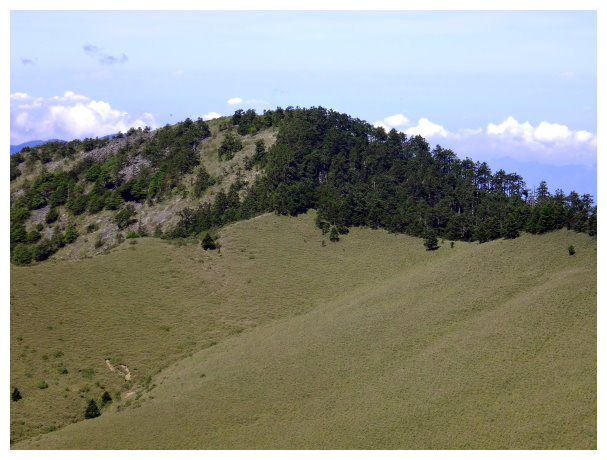
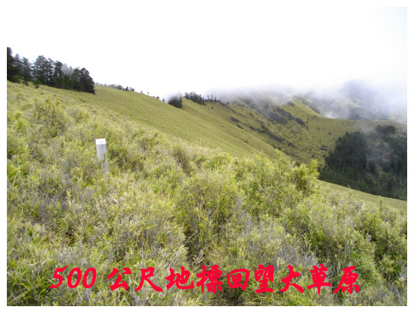
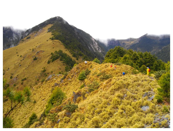
09:14 at an intersection. An indicator < right to Xiaonanshan, go straight to South Yushan 2.0K >. The beautiful green field was ahead. This was a tough hike, but worth the effort.
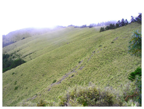
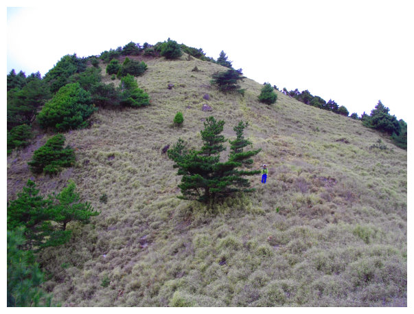
09:55 at <South Yushan 1K>. it was a big grass field.
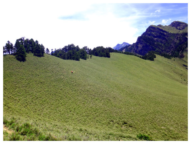
10:08 an indicator < 500 Meters >. Still walking on grass slope.
10:15 an indicator < back to Yuanfong Cabin 3.5K & to South Yushan 0.2K >
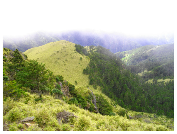
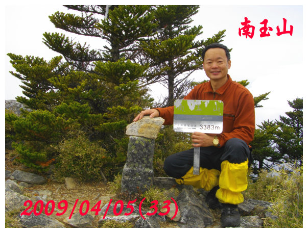
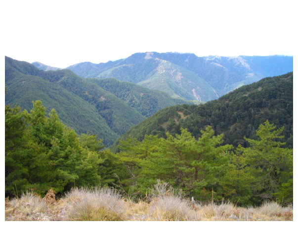
10:20 got to South Yushan. The weather was find and the view was beautiful. The dangerous cliff was in the south of the mountain. Yushan West Peak, Front Peak, visitor center and the trailhead could be seen from here. The mobile phone was accessible here.
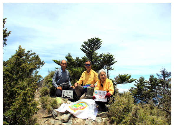
¤T½÷¦@µn(©ú½÷¡B©v½÷¡B°·½÷/¨ä¤¤©v½÷¥H65°ªÄÖºaµn²Ä99®y¦Ê©¨§ó¨¬±o³Üªö¡C)

11:24 returned.
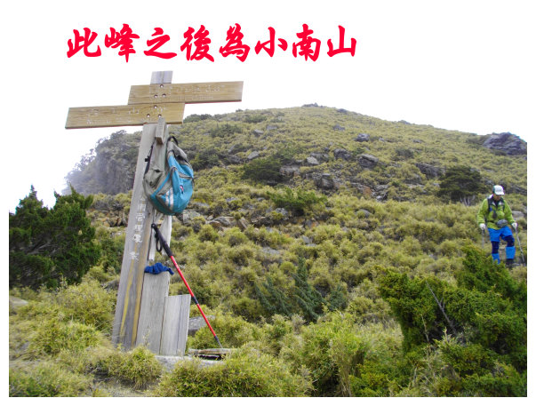
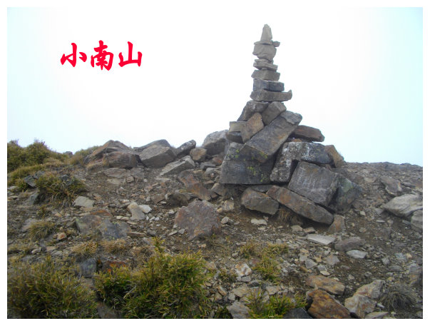
12:30 went to the trailhead of Xiaonanshan. 10 minutes later, we got to Xiaonanshan. There was no summit mark on the top. It was an elevation of 3582 M, and wasn¡¦t on the list of 100 Peaks.
13:25 back to < South Yushan 2.6K & Yuanfong Cabin 2.9K> indicator.
14:25 back to the second water source and filled some water to drink. 10 minutes later, we went back to < Yuanfong 1.5K> indicator.
15:10 back to the first water source and the indicator < South Yushan 4.2K & Yuanfong Cabin 1.3K >. We took a short break here.
16:00 went back to Yuanfong Cabin and stayed overnight.
D+3 Yuanfong Cabin / Yushan South Peak / DongXiaoNanShan / Lushan / stayed a night at Yuanfong Cabin
04:00 packing light, we started our hike before dawn.
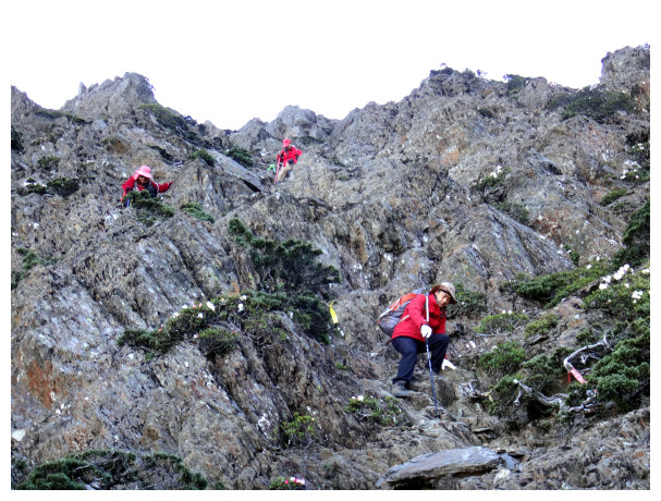
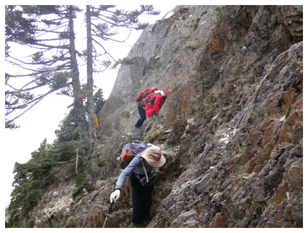
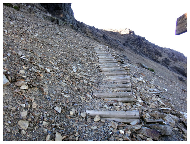
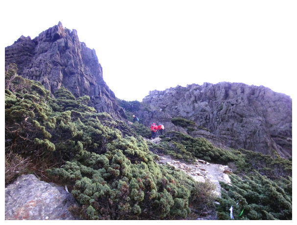
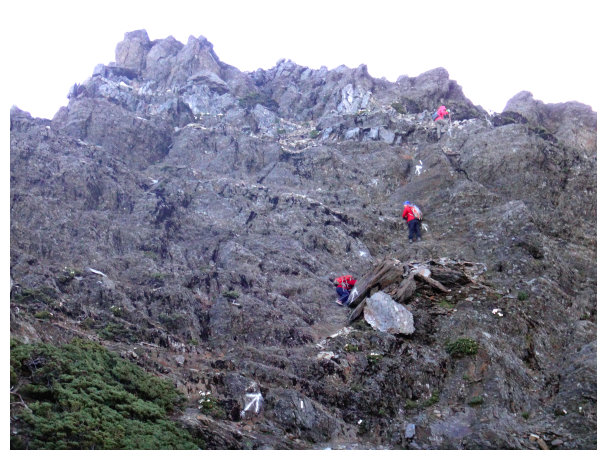
04:22 at an intersection. An indicator < right to South Yushan 4.7K & go straight up to DongXiaoNanShan 1.6K & Yuanfong Cabin 0.8K >. We went straight and stepped on wooden stairs up. In the beginning, the trail was covered with gravels, and at the end, there were some chains on the rocky wall.
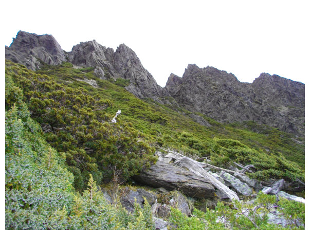
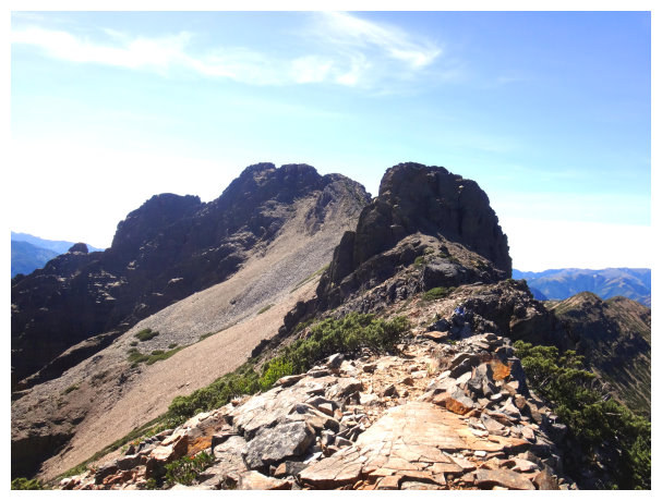
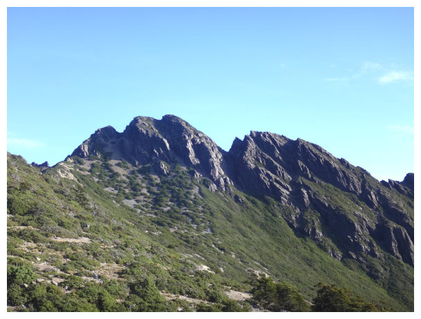
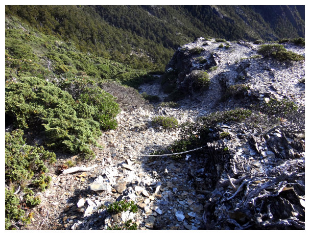
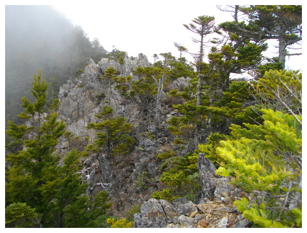
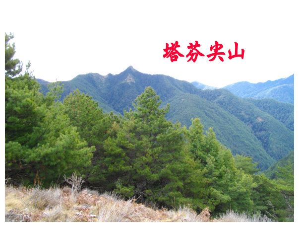
04:40 an indicator < Dongxiaonanshan 1.4K & Yuanfong Cabin 1K >. We took the left way and then took a detour to the left down to Sancha Peak(¤T¤e®p). It was a series of sharp peaks separated by steep rock trenches. It was a tough hike.
05:00 got to an indicator < Yuanfong Cabin 1.4K >
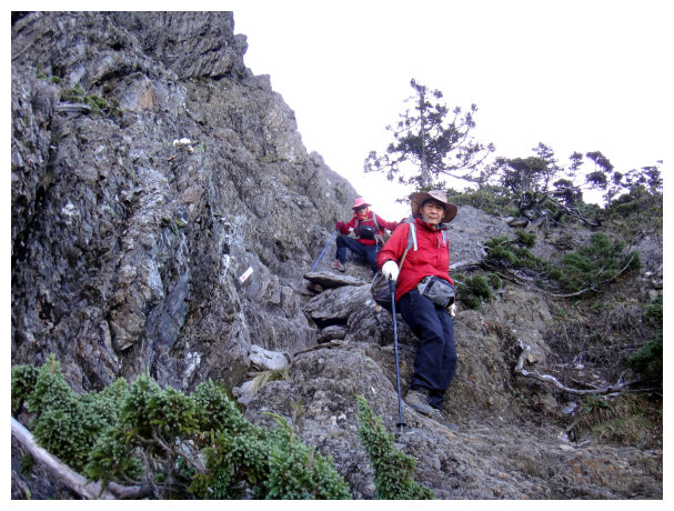
05:07 got to an intersection, an indicator < South Peak 0.2K & DongXiaoNanShan 0.9K & Lushan ? K & Yuanfong Cabin 1.5K >.Unloaded our backpacks and took the left way to South Peak. We followed the white colored arrows to walk on the rocky wall.
05:20 Yushan South Peak. After taking some picture, we returned

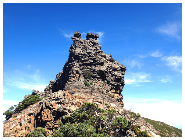
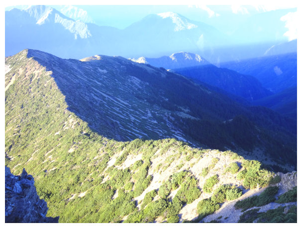
05:46 back to an intersection and we went to Dongxiaonanshan. The trail was 900 meters long, but it was a slope of schist. The scenery was wonderful.
06:20 an intersection, an indicator < left to Lushan, to Dongxiaonanshan 0.1K >. We took the way to Donxiaonanshan.
06:25 got to Dongxiaonanshan. After taking pictures, we returned.
06:40 back to the intersection. We took the way on the right to Lushan. This route was the toughest in this hiking trip. It was steep and jagged, climbing up and down again and again.
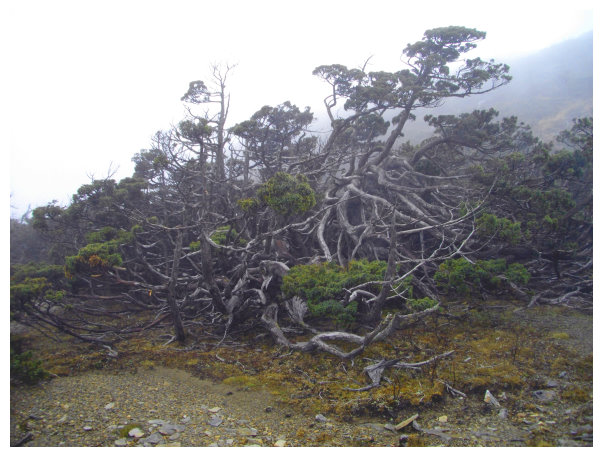
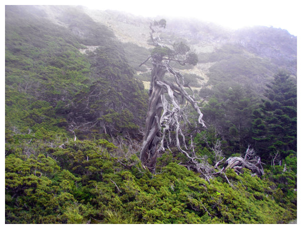
07:00 down to a platform. There was a beautiful Yushan cypress on the right.We went straight and then turned right to go down about 30 meters. Turned left toward South Peak and took a detour.
07:20 there was a water source. It was an intersection. An indicator < Yuanfong Cabin & Lushan>. We went straight to Lushan.
07:30 an intersection, an indicator < left to Yuanfong Cabin & right to Lushan 3.9K & Dongxiaonanshan>. We took the way on the right side down to Lushan.
08:37 got to kilometer 2.7 . the trail wasn¡¦t clear, but there were some indicated strips along the way.
10:00 got to an indicator < Lushan 1.2K & Yuanfong Cabin 6.8K >.
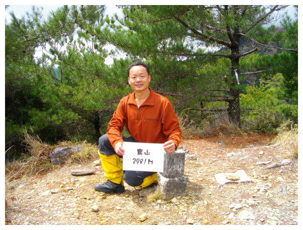
10:45 Lushan. Altitude: 2981M. it was on the list of 100 Peaks in Taiwan. We took a rest and had lunch until 12:00.Because we were exhausted and needed to charge enough energy.
16:10 back to an intersection and an indicator. We took the way on the right to Yuanfong Cabin.
16:20 back to an intersection and indicator. We took the way on the right toward South Peak. Later, we met an intersection again, and took the way on the right to go.
16:40 passed by an intersection.
16:58 back to a place which was below the Sancha Peak.
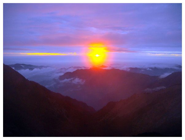
17:30 back to Yuanfong Cabin and enjoyed the sunset.
D+4 Yuanfong / Paiyun Lodge / the trailhead of Yushan / Tataka Parking Lot / Chiayi
06:00 got ready to go home.
07:15 back to Paiyun Lodge. We took a break for 25 minutes.
08:48 back to kilometer 4.8 ,the observation platform. And took a break for 20 minutes.
08:10 back to kilometer 7.6 , the big rocky wall. We took a break for 10 minutes.
09:55 back to 2.8K , the trailhead of Yushan Front Peak and took a break for 5 minutes.
10:23 back to 1.5K at Monroe Pavilion(©s¸S«F) and took a break for 10 minutes.
11:00 back to the trailhead and took the shuttle bus to Tataka Parking lot.
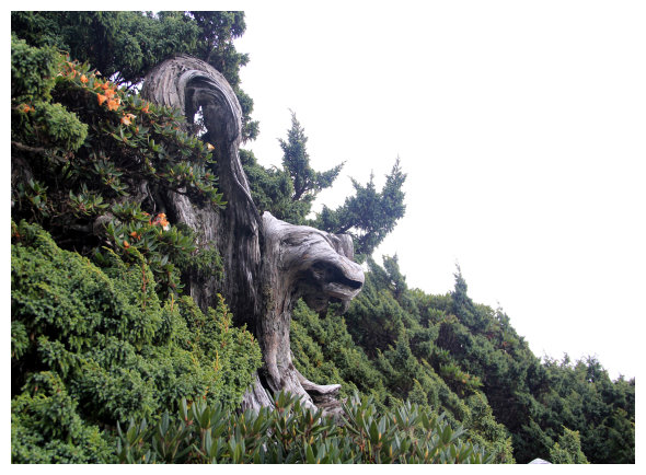
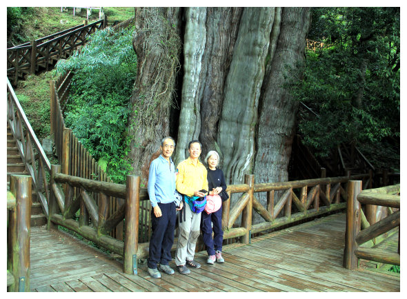
11:40 After watching the second oldest sacred tree in Taiwan, we drove to Shijie (¥Û槕) to have lunch, and then drove to Chiayi.
15:40 back to Chiayi.
