Mountain Bilu difficulty : 5.9、viewing: 5.5
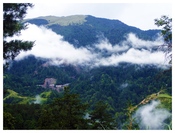
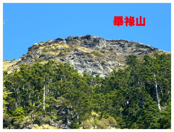
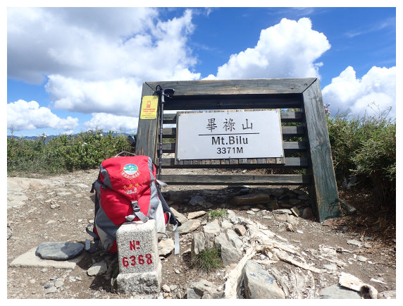
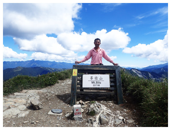
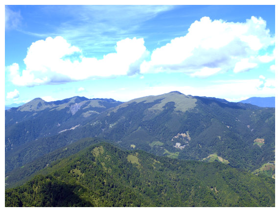
The elevation of Mountain Bilu is 3371 meters. The trailhead is located beside Dayuling大禹嶺 Tunnel on Zhongheng Highway 中橫公路(at kilometer 111.8). A summit mark No. 6368 is on the top , and it is ranked #39 on the list of 100 peaks. The summit has a 360-degree outlook, and you can see central range point while viewing the north. To the west, you can see Mountains above 3000 meters, such as Dayuling Ridge, Pingfeng Mountain ,Qilai North Peak, Hehuan North Peak, and its visitor Center.
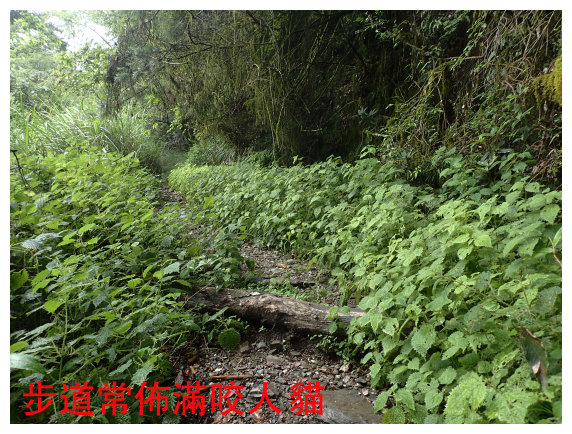
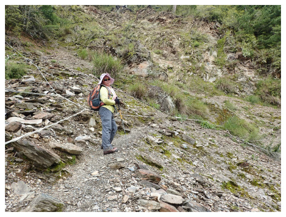
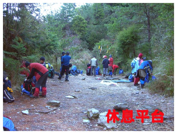
The route to the summit consists of two sections. The front section is a forest-road #820 whose length is 8.4 kilometers long. It used to be accessible by car. Now it takes 3~4 hours to walk on foot. Fortunately, the road is flat ,and the water source is sufficient. The rear section is a mountaineering-road. It is really steep about 2 kilometers long to ascend up for 801meters, which is the hardest part of this journey. It takes 10 to 12 hours for a round trip which is more than 20.8 kilometers long. There is a mile mark every 100 meters on the route. The way is so clear that it is very popular for hikers. It is hard to find a space for parking especially on holidays.
Link : [Treking from Bilushan to Yangtoushan] 。
Details: 2009/01/01 & 2011/09/17 & 2017/06/29
Day -1 Chiayi(嘉義) / bound for Puli(埔里) from National Highway No.6 /Mt. Hehuan / Dayuling(大禹嶺) / Guanyuan (觀雲)Gas Station Parking Lot
14:00 Starting from Chiayi,we drove to Dounan to pick up a friend.
15:40 Got off National Highway No.6 at Puli exit. We bought food for tonight and tomorrow at a convenience store 7-11 which is near the National Highway Exit.
19:00 Stayed at Guanyuan Gas Station Parking Lot for a night
Day 1 forest-road #820/ Mountain Bilu / back to forest-road #820 / back to Chiayi
03:00 got up and ate breakfast. Drove to Dayuling
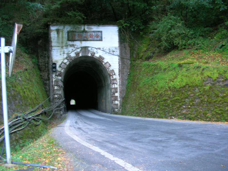
(大禹嶺) and pass through the tunnel toward the direction of Lishan(梨山).
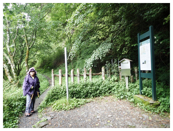
04:15 parked at the exit of the tunnel (the parking space only for 4 cars). Put the admission to the box which is next the fence on the right. Commenced the hike to Mountain Bilu before dawn.
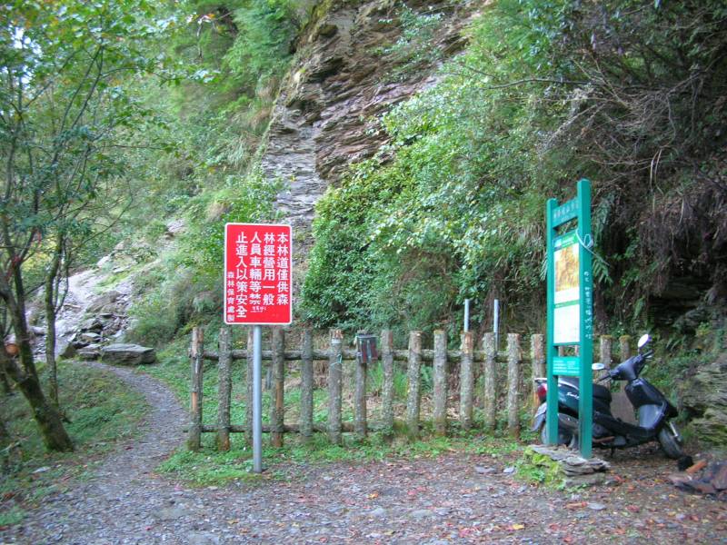
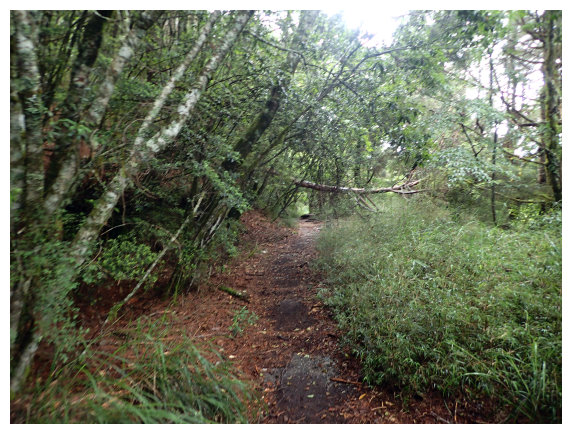
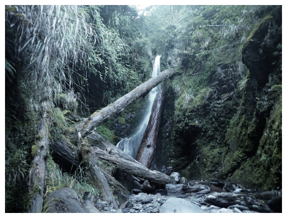
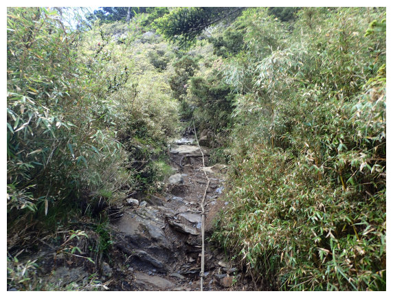
04:35 at kilometer 1. It was a junction of 3 paths. Took the left path along the forest-road.(do not take the path on the right, or you will end up meeting a small waterfall and get lost.)
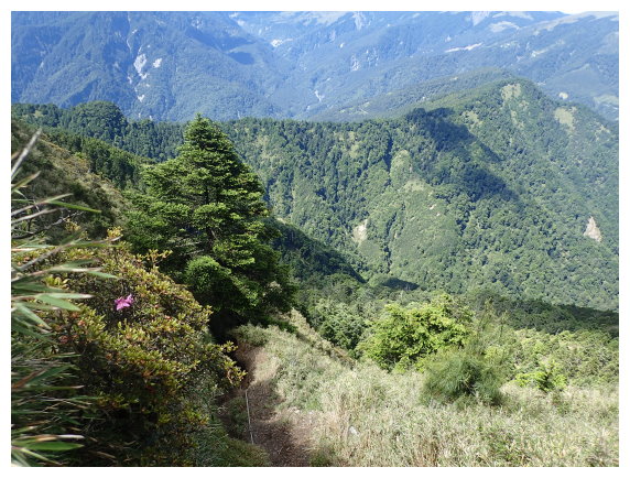
05:37 at kilometer 3.6. the sky was clear, and the view of Tai 8 Highway to the direction of Lishan was nice.
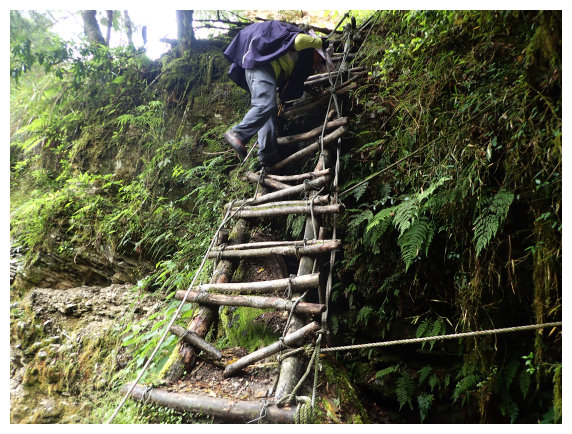
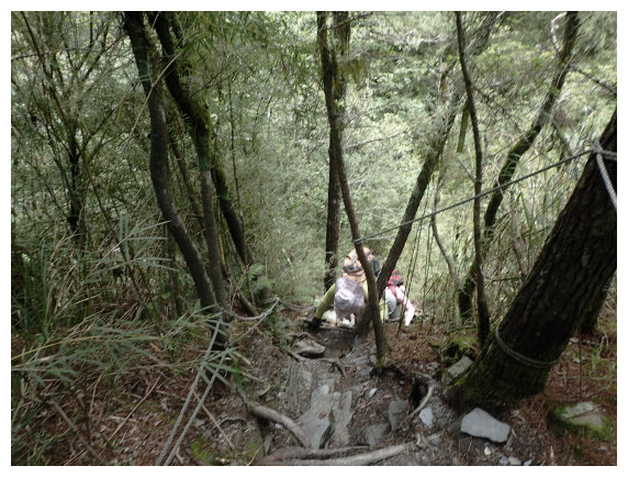
06:10 at kilometer 5.2 , descend a little then ascend a little by climbing up a wooden ladder.
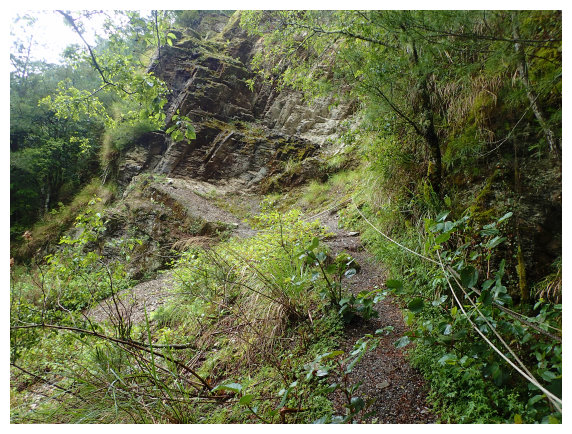
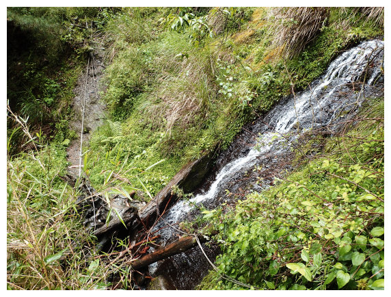
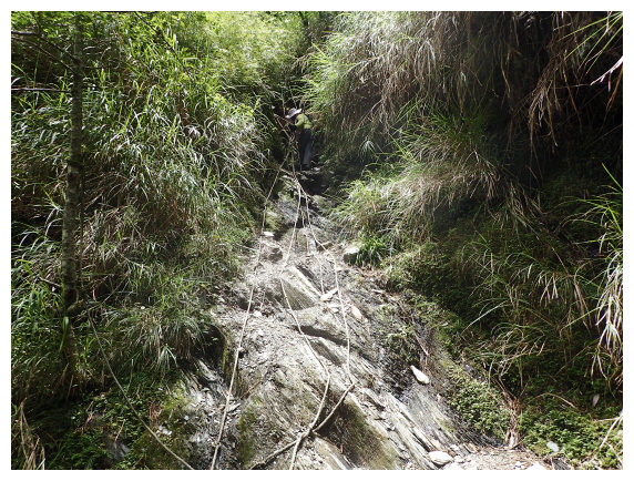
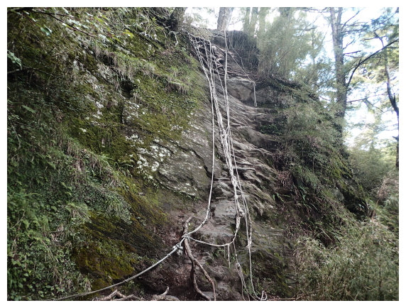
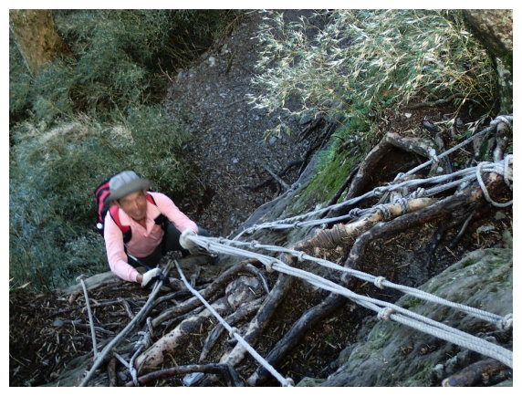
06:30 at kilometer 6. There was a small waterfall and a small landslide. We needed to hold the rope for climbing up.
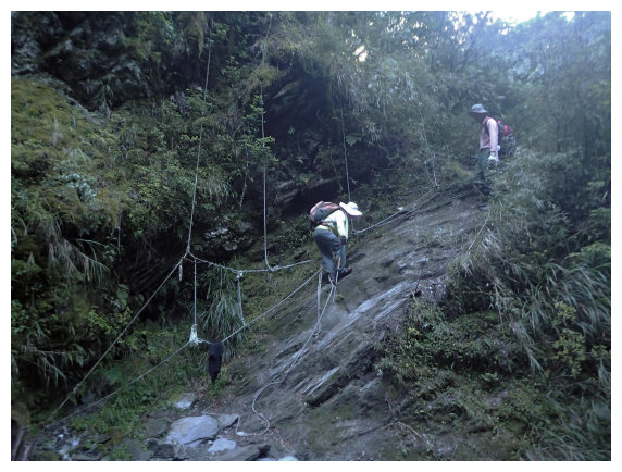
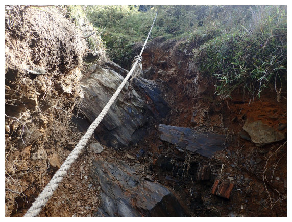
06:55 at kilometer 6.9. There was a serious landslide, and we also climbed up by holding ropes.
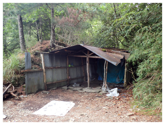
07:10 at kilometer 7.5 There was a broken shelter made of iron.
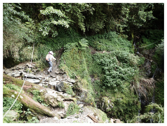
07:15 Descended a little and went through the path of silver grass.
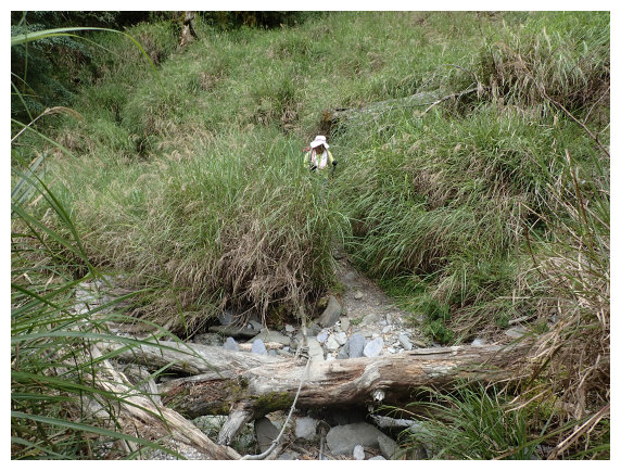
07:20 met a small landslide, a small stream, and a waterfall. we climbed up and down by holding ropes.
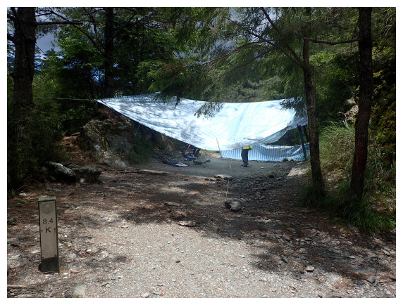
07:25 at kilometer 8.4 (2 kilometers away from mountain Bilu) We arrived at a flat site(H2571M), took a rest and enjoyed the sweet water from the stream which was a minute walk away.
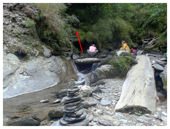
08:00 started hiking. Descended a little and crossed the small stream. We took the path on the right and went through arrow bamboo trail. Started climbing up for more than 200 meters ascend.(we needed to ascend up for 760 meters to the top of mountain Bilu)

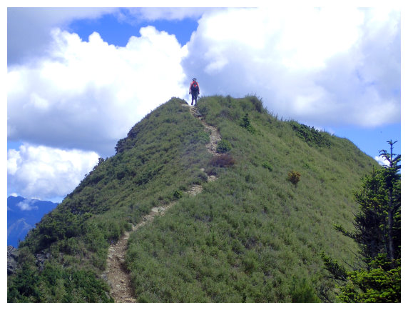
09:04 At kilometer 9.6 This is a cliff about 30 meters high. It took us 3 minutes to climb up and then saw the pine trees along the way. The higher we climbed, the pine trees were gradually replaced by arrow bamboo, and the view was clear.
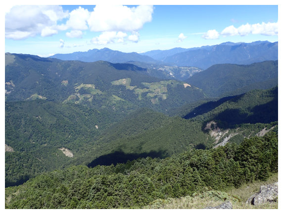
09:30 At kilometer 10 It was really steep, but the view was clearer. We could see the north peak of Hehuan,the north peak of Qilai and mountain Pinfeng.
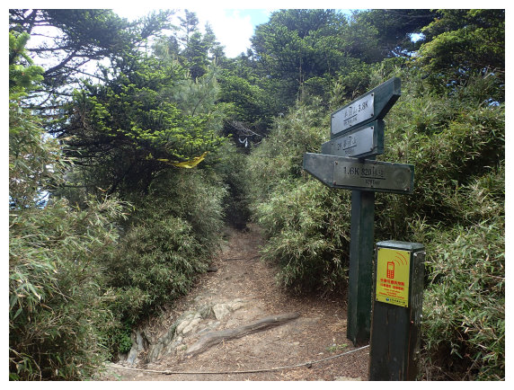
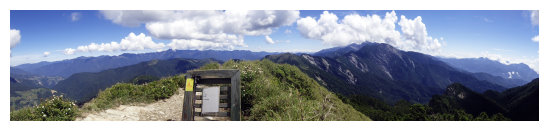
09:48 there was a mile mark.( right to Mt.Yangtou 3.8K & left to Mt.Bilu 0.2K & back to #820 forest-road 1.6K ) We took the left path to go.
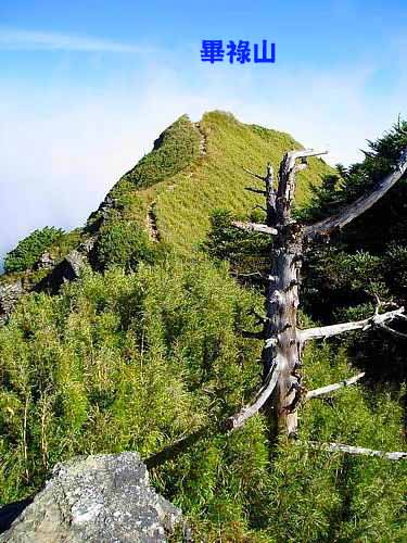
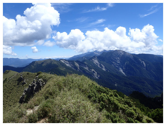
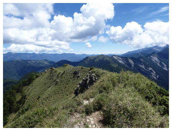
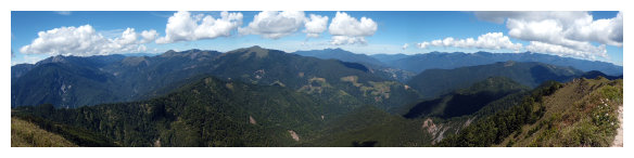
09:50 There was a summit mark on the top of Mt.Bilu. The weather was quite good and the view was wonderful. We could see Mt.Snow, Central Mountain range, the north peak of Hehuan, Hehuan visitor center, the north peak of Qilai and Mt.Pingfeng. After 40 minutes of rest, we returned along the original path.
11:50 Back to the flat site and had lunch for 40 minutes.
15:40 Back to the Exit of #820 forest-road and drove to Chiayi.
