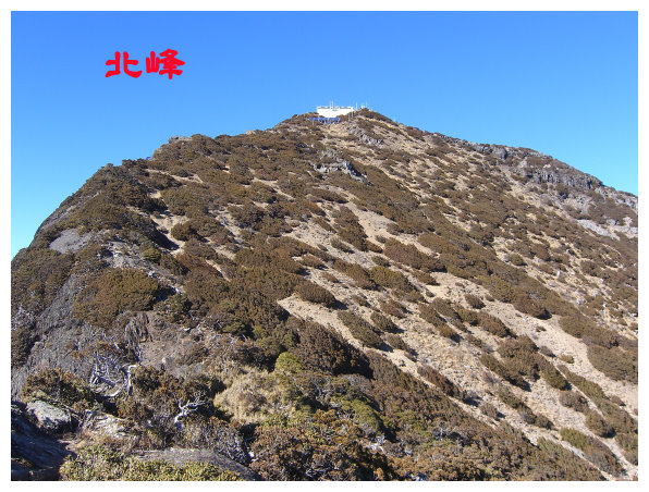
Yushan North Peak and Main Peak
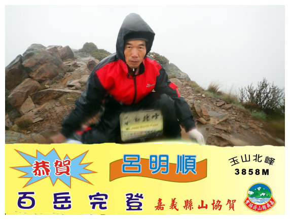
Yushan North Peak: 3,858M above sea level, it was ranked NO.3 on the list of 100 Peaks in Taiwan, whose scenery was at the first place of Taiwan 8 beautiful mountains above 3000 meters (玉山北峰Yushan North Peak, 向陽山Siangyang Mountain,東巒大山 Tungluanta shan, 志佳陽大山Zhijiayangdashan, 桃山Taoshan, 郡大山Jyunda Mountain, 鈴鳴山 Mt. Lingming, 閂山 Mt. Shuan).
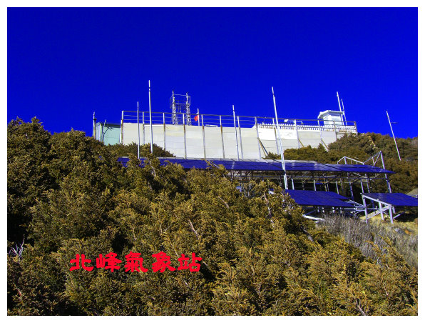
There was a meteorological observatory, which was the highest altitude weather station and the government institution in Taiwan. The trailhead of Yushan North Peak was located below the main peak. The distance between them was only 200 meters away. Most hikers would climb the Main Peak and the North Peak in a trip.
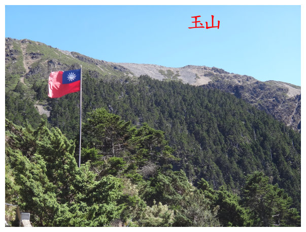
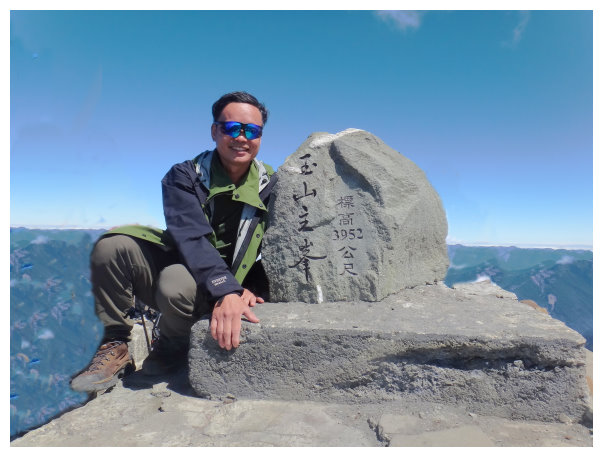
Yushan:Mt. Jade, an elevation of 3952, is the highest mountain in both Taiwan and Northeast Asia. It is situated around 8 peaks over 3000m and stands on the Centre of Taiwan( spans over Nantou County, Kaohsiung City and Chiayi Count). It is also considered as a holy mountain by Bunun and Tsou tribes.
Itinerary:
Day -1 Chiayi/ stayed a night at Dongpu Lodge
18:30 started from Chiayi
21:00 Dongpu Lodge. ( NTD 400/a night. It offers meals, if you reserve in advance. )
Day 1 the trailhead of Yushan / stayed a night at Paiyun Lodge
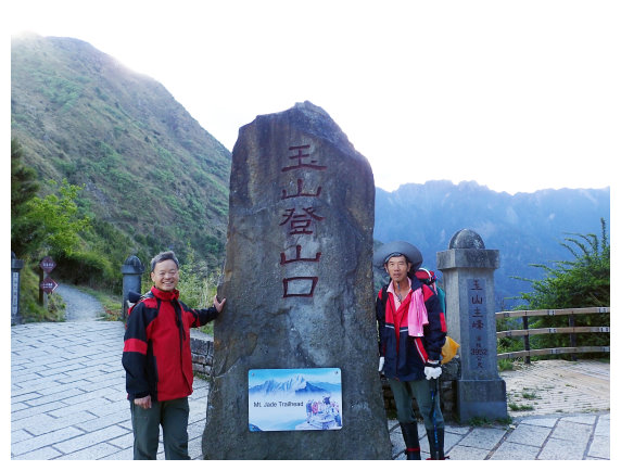
06:30 Got to Tataka Parking lot and started our hike.
06:45 after checking the Park permit at Paiyun Mountaineering Center(排雲管理站) and the Mountain Entry permit at Tataka Squad(塔塔加小隊), we took the shuttle bus.( the shuttle bus goes from the checkpoint to the trailhead of Yushan. shuttle bus :100NT/each person. It takes 1 hour for a walk of 2.4K from the checkpoint to the trailhead of Yushan).
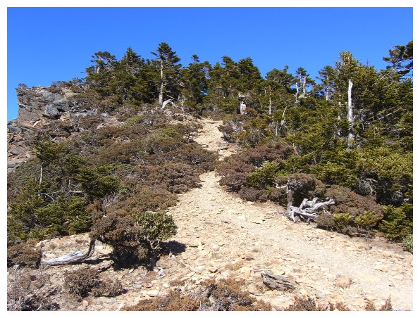
07:10 Starting from the Yushan(Mt. Jade) trailhead at Tataka Saddle (elevation: 2610m). The paths to Lu Lin Shan(鹿林山), Shi Shui Shan(石水山), Lu Lin Qian Shan(鹿林前山), Lin Tou Shan(麟趾山) were just across from the Yushan (玉山)trailhead .Travelers could also view the beauty of Mt. Jade on the top of those mountains.
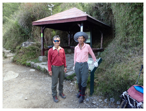
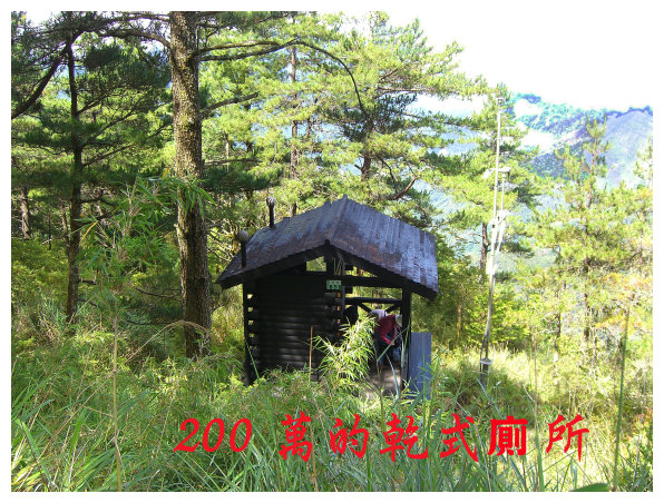
08:00 at 1.7 K, hikers usually take the first rest at Monroe Pavilion(孟祿亭), which stands on the an elevation of 2838m and is located at the border of temperate forest and cold forest. (There is a dry-eco toilet on the right behind the pavilion.)
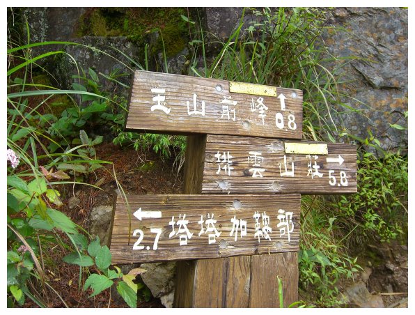
08:30 at 2.7K, it is the trailhead of Yushan front Peak(玉山前峰). (elevation : 2823m) Hikers may go hiking to Yushan front Peak on the way back after finishing Yushan trip.
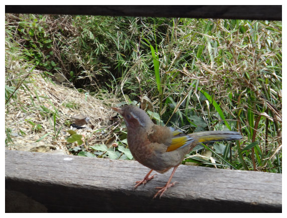
09:25 At 5.K,we could see the main peak from here. There are special birds in Taiwan called Formosan Laughing Thrushes coming for food, but It’s not allowed to feed those animals in the wild. (A toilet is near around at 4.9K.) The way from kilometer at 5.1K to 5.5K was a ascending path.
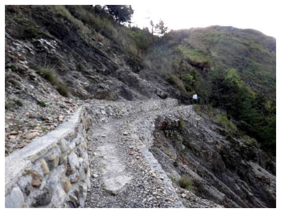
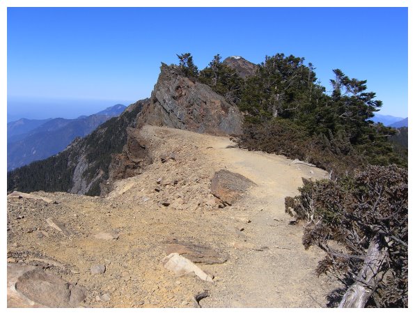
10:25 At 6.7k,we pasted by The Great Precipice(大峭壁)
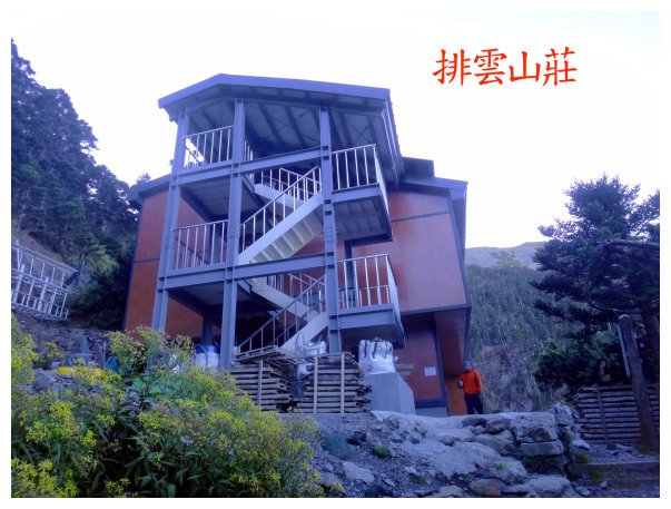
11:15 got to kilometer 8.2. we could see Paiyun Lodge from here. The lodge was situated in the fir forest. We kept ascending up to get to the lodge, which was 300 meters away.
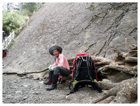
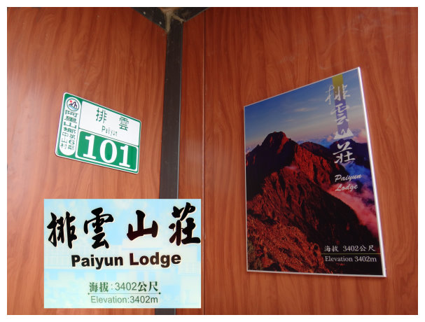
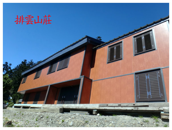
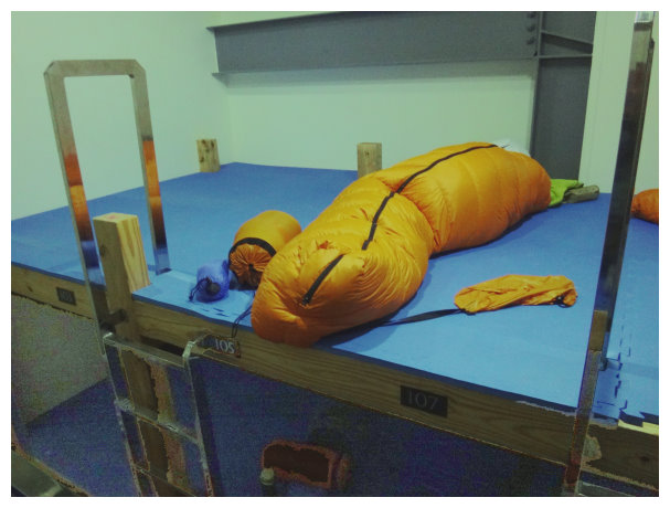
11:35 At 8.5K, arrived at Paiyun Lodge (elevation 3402m): NTD 480/a night, provided meals for vegetarians and non-vegetarians.(breakfast, brunch /150 NT dinner/300NT sleeping bag/300NT )
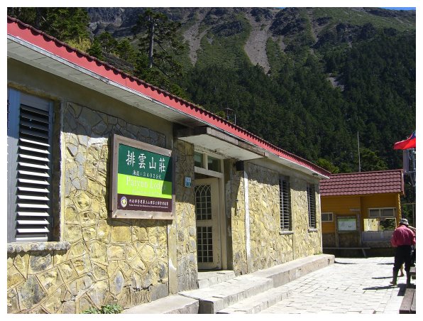
舊排雲山莊
排雲山莊觀玉山
Day 2 Paiyun Lodge/ the intersection of the trailhead of North Peak and Main Peak / Yushan North Peak / Yushan Main Peak / Paiyun Lodge / back to Chiayi
02:00 getting up for breakfast.
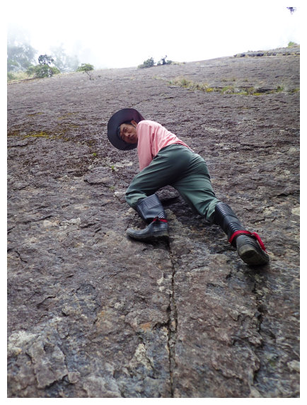
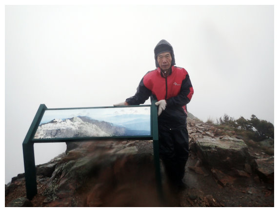
03:00 we started hiking before dawn. It was raining, and hikers stayed at Paiyun Lodge were not hiking up to the Main Peak. But it was climbing partner’s 60th birthday, we still went up to hike to Main Peak to celebrate this significant day.
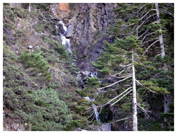
03:12 a sign<0.5K>. Standing on the No.86th wooden bridge, you could see A waterfall, which is located around 0.4K. (the waterfall formed only in rainy season )
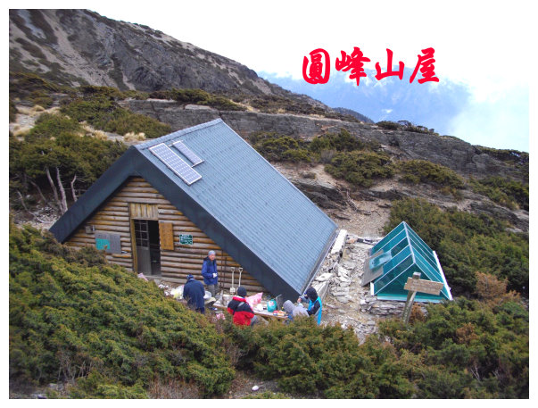
03:20 a sign<1.5K to Yuanfong Camp (圓峰營地) ; 1.7 to main peak> Going to the right is the route to Yuanfong Camp, which is the way to Yushan South Peak(玉山南峰)、South Yushan(南玉山)、Dongxiaonanshan(東小南山)、Lushan(鹿山).We took the left path to the peak of Mt.Jade.

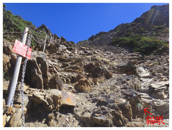
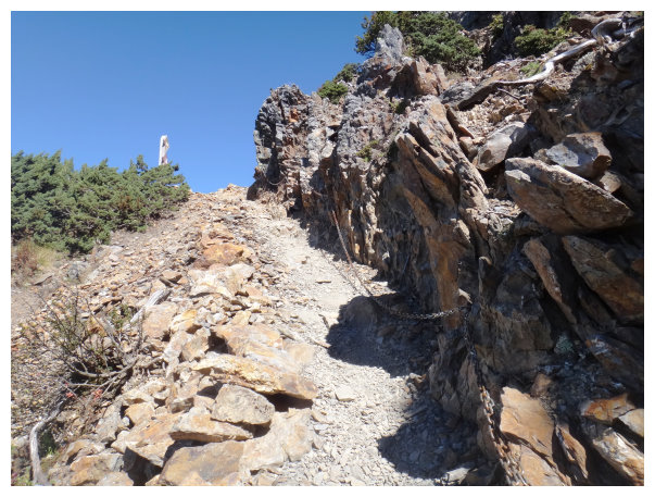
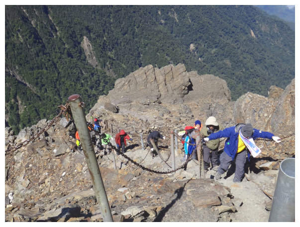
03:35 a sign <scree(碎石坡)>.The main peak is 600 meters away from here. On the up left, there are metal chains and posts which could help hikers ascent to the main peak, but it’s not allowed to go along this path except in snow season. We took the path, which little cat’s-eye stone were reflecting on the way, and switchbacked up to the Peak.
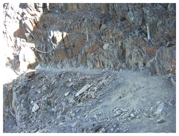
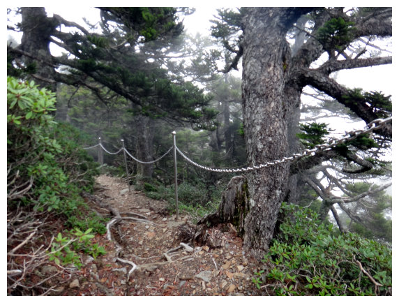
03:40 a sign <0.4K>, there are metal chains along the way for hikers.
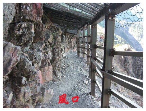
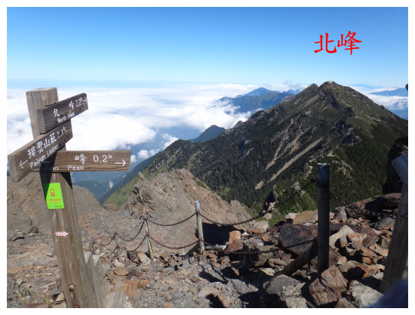
03:55 at the intersection of the Main Peak and the North Peak “the wind hole (風口)”<2.2K to the North Peak(北峰)、0.2K to the Main Peak. > we took the path on the left and descended down to the North Peak.
04:05 at the intersection of (八通關古道) Batongguan Historic Trail. a sign says : < go straight to the North Peak 1.9K and right down to the trail of Batongguan >
04:10 down to the bottom of a valley. It was a flat area, and Taiwan Alpine Rhododendrons were blooming around.
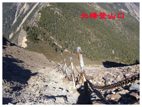
04:25 a mile marker <the North Peak 1.4K> there were chains on the side along the way. This was a ridgeline. We ascended and descended again and again.
05:00 a sign said: the North Peak was 「0.4K」away. the path was a 45-degree ascending slope and covered with gravels. Taiwan Alpine Rhododendrons were around.
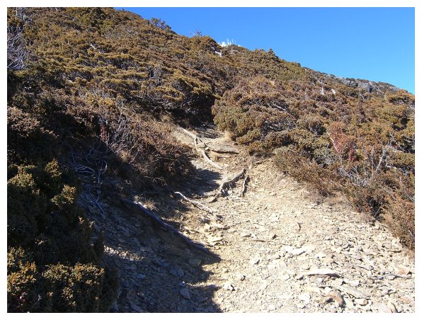
05:25 Arrived at the weather station, the summit marker was located at the right rear of the weather station. The weather station personnel had not yet got up (sometimes the weather station staff would treat hikers hot tea to drink.), we hoped the rain stopped, but it still rained a lot. After taking a 30-mins break, we returned.
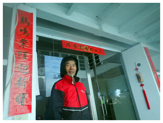
體力不輸年輕人的呂明順,於60歲當天完登台灣百岳。
07:15 back to the wind hole. Due to the rain, for the safety reason, we didn’t hike up to the Main Peak.
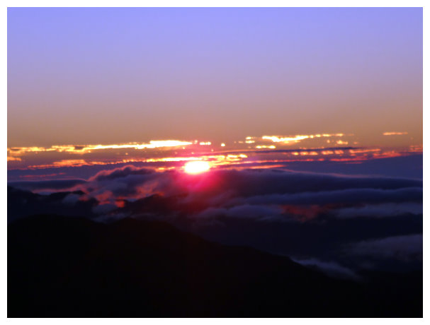
玉山之晨
玉山倒影
09:00 returned back to Paiyun Lodge to enjoy a meal for an hour.
13:00 back to the trailhead of Yushan and took the shuttle bus to Tataka Parking lot, and then drove home.
another journey
Chiayi / Dongpu Lodge (it was 2.5 hours drive.)
Yushan management station / the trailhead of Yushan (it was 20-mins drive.)
